after…

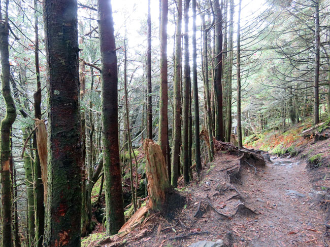
“Shelter along the Appalachian Trail” by Carol M. Highsmith

The forest behind my house is already becoming something new, I notice, as I walk trails that used to be shady. With so many fallen giants, the floor now lies under open sky. I count sprouting acorns by the dozens, arching their necks and reaching for a new bonanza of sunlight. I have so many hopes for this place I love. Mostly that we’ll rise like these seedlings from our scoured landscape, blessed with the kindness we’ve shared with our neighbors and the will to extend our care to those who follow behind us on these paths.
~ Barbara Kingsolver
(Southern Living, May 2025, “The Heart of Appalachia”)

On September 27 last year Hurricane Helene tore through Appalachia, affecting the community in Virginia where author Barbara Kingsolver lives. It also devastated 29 of North Carolina’s 100 counties, which are part of the same geographic region. (The county where we live is in the Piedmont region.) For some reason I never mentioned this disaster on this blog last year, probably because I couldn’t process what I was learning about it in real time.

Our grandchildren had no school that day so we had planned to take them to the Carolina Tiger Rescue. The day before, the weather forecasters warned of torrential rain for our area but the tour is by reservation only and the website said it would happen rain or shine. So we were prepared and bought rain ponchos for the four of us. But that morning the Rescue cancelled the tour and we stayed home. I’m glad we didn’t risk getting caught in a flash flood on the roads. It rained a lot and we had two tornado warnings during the day, which sent us to hunker down in the bathroom, but thankfully we weren’t hit. The disruption to our lives was nothing compared to what was happening to our neighbors only a few hours away.

A year earlier in October, we had stayed for a weekend getaway in the beautiful town of Black Mountain. We had a wonderful time walking through the town, visiting Mount Mitchell, hiking the Balsam Nature Trail in the state park, and driving along the scenic Blue Ridge Parkway. Little did we know Black Mountain would experience catastrophic flooding from the storm. Roads and bridges were damaged or washed away. The pictures we saw on the news were shocking and sobering. But since then the stories being shared of kind people helping one another have been heartwarming. I hope we can plan another visit some day.

However, the severely limited federal response under the current administration has been disturbing. According to our governor:

In addition to the $13.5 billion that I am requesting of Congress in new appropriations, North Carolina has yet to receive billions of dollars that Congress worked together on a bipartisan basis to appropriate last December. Just as I asked in February, I am urging federal agencies to take action to unlock those funds so we can put them to work as soon as possible where they are desperately needed.

We are grateful for every dollar that brings us a step closer to recovery, yet current federal financial support is not enough. In total, federal support amounts to approximately 9% of the total damage western North Carolina suffered. Many of the largest, most devastating storms, like Katrina, Maria, and Sandy, saw upwards of 70% of damage covered by federal funding, and from available historical data, the federal government has typically covered between 40 and 50 percent of costs caused by major hurricanes. The people of North Carolina deserve a fair shake, just like the residents of other states and territories.

~ Gov. Josh Stein
(Hurricane Helene Recovery, September 15, 2025, Federal Funding Request)

overlook at milepost 361.2

10.10.23 ~ view of Glassmine Falls
Blue Ridge Parkway, Pisgah Region, North Carolina

On our way back to our hotel in the charming little town of Black Mountain we retraced our drive along the Blue Ridge Parkway. This overlook was especially beautiful. We saw some fall colors but they hadn’t come to a peak yet.

The waterfall (below) was dry on this day but apparently after a good rain a narrow stream of water falls 200 feet over the cliff. That dark hole at the base is an old mica mine. Mica is sometimes called isinglass and miners called it glass for short, which is why it was called a glassmine.

Glassmine Falls
valley on the other side of the overlook
path back to parking lot, elevation 5,200 feet

The clouds were always on the move, casting dramatic shadows over the peaks and valleys and changing the lighting moment to moment. It was a nice way to end a most wonderful day.

through a spruce-fir forest

10.10.23 ~ start of Balsam Nature Trail
Mount Mitchell State Park

Another trail! After visiting Mount Mitchell’s peak we found the Balsam Nature Trail, a 3/4 mile loop off of the Summit Tower Trail. The terrain here was very uneven, much to Tim’s relief after the flat pavement going up to the summit. Lots of up and down, even steps in some places and narrow passages between outcrops.

We didn’t encounter any wildlife or hear any birds calling. I’m guessing because this is a well-traveled trail and the creatures are hiding from people, if they are there at all. Every few minutes a couple or a family or small group of friends would overtake us and pass us. And just as often we’d pass folks hiking in the opposite direction. It was the most traffic we’ve ever experienced on a trail.

huge outcrop
ferns everywhere
a hemlock sapling – good luck precious little being

The best part of this walk could not be photographed — it was the amazing scent of balsam and Fraser fir. What an unforgettable olfactory delight!

Sadly, though, there wasn’t much left of healthy evergreen foliage. Most of the green we saw was mosses and ferns.

I am very familiar with the hemlock woolly adelgid insect pest that destroyed the hemlock grove surrounding my childhood home. It originated in East Asia and arrived here in 1951. According to Wikipedia, by 2015 90% of the geographic range of eastern hemlock in North America had been affected.

But I had never heard of the balsam woolly adelgid until I saw it mentioned on a trailside sign, explaining why there were so many dead and dying trees in this forest. This insect pest arrived here from Europe in 1900 and was discovered in this forest in 1957. The devastation is obvious in many of these pictures.

Mosses and mushrooms seem to be thriving with such an abundance of dead wood. I tried to identify the moss in the above picture — it seems to be some kind of feather moss. It looked different than the mosses I usually see. According to Britannica there are approximately 12,000 species of moss distributed throughout the world.

The spruce-fir forest is a forest type dominated by needle-leaved, evergreen red spruce and Fraser fir trees. It exists only at elevations above 5,500 feet, and contains plants and animals that are adapted to cool, moist conditions. Some of the plants and animals living in Mt. Mitchell’s spruce fir forest are found over much of the state. Others, however, are the same as (or are close relatives of) those found in the spruce-fir forests of New England or southern Canada.
~ trailside sign

The climate of a spruce-fir forest can be harsh. Wind and ice storms are facts of life here: trees with their tops missing are common sights. And, as with any high-elevation ecosystem, rain, fog, sleet or snow can occur unpredictably — in any month, at any time of day.
~ trailside sign

uneven uphill terrain
halfway point

Though spruce-fir forests are found in a broad region of northern North America, they occur south of New England only in a thin zone along the Appalachian Mountain chain.
~ trailside sign

red spruce roots

All that being said, I was still enchanted with this forest and will cherish my memories of this little taste of New England here in North Carolina.

to the observation deck

10.10.23 ~ start of Summit Tower Trail
Mount Mitchell State Park, Burnsville, North Carolina

It was a steep quarter-mile trek from the parking lot to the summit and observation deck, but the view at the top of Mount Mitchell was well worth it!

Elisha Mitchell (August 19, 1793 – June 27, 1857) was an American educator, geologist and Presbyterian minister. His geological studies led to the identification of North Carolina’s Mount Mitchell as the highest peak in the United States east of the Mississippi River. … Elisha Mitchell fell to his death at nearby Mitchell Falls in 1857, having returned to verify his earlier measurements…
~ Wikipedia

looking up from along the trail
one of the rest stops Tim made good use of
a view from along the trail
I believe these are other mountains in the Black Mountains range

After reaching the summit we went up a ramp to the observation deck. From there we had an impressive 360-degree view of forests, mountains and clouds, as far as the eyes could see.

On the way back down I started noticing the many kinds of lichens growing on the trees and the wooden fences.

Sometime back in the 1980s we took our kids on the Cog Railway up Mount Washington in New Hampshire. All this time I thought it was the highest mountain on the east coast, until moving to North Carolina and reading about Mount Mitchell, which is 396 feet higher!

Mount Washington, in New Hampshire, is the highest peak in the Northeastern United States at 6,288.2 ft (1,916.6 m) and the most topographically prominent mountain east of the Mississippi River.
~ Wikipedia

I can see what is meant by Mount Washington being the most topographically prominent mountain, though. Mount Mitchell is surrounded by other peaks in the Black Mountains range, which has 12 summits higher than Mount Washington’s.

I had another treat waiting for me as we headed back down the trail.